Landforms are natural physical features of the Earth's surface. As an element of topography, a landform is defined by its shape, location and how it was formed. Take a look at examples of landforms found on our planet as well as the minor landforms found in different biomes.
Major Landforms
There are four major types of landforms on Earth: mountains, hills, plateaus and plains. When you picture these landforms, you might imagine large mountain ranges or wide plains. But these geographical landforms don’t only exist on dry land - they’re found on the ocean floor as well. Take a quick trip around the word with these examples of major landforms on the planet.
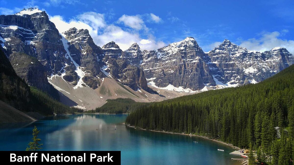
Examples of Mountains Around the World
Mountains are major landforms with higher elevation than the land around them. They have steep slopes and a summit, which is the highest point of elevation. Mountains are formed when tectonic plates collide and push land upwards over millions of years, and shaped by wind and water erosion. Other mountains are actually dormant volcanoes that have not erupted in a very long time.
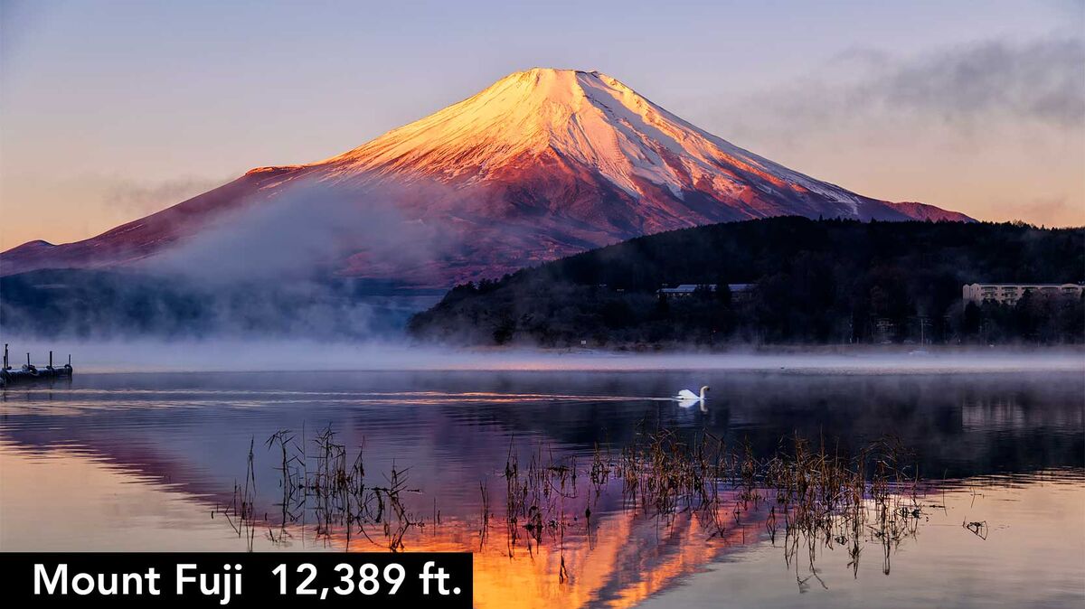
Some examples of mountains and their elevations include:
- Aspen Mountain (Rocky mountain range, Colorado) - 10,705 ft.
- Bear Mountain (Kenai mountain range in Alaska) - 4,019 ft.
- Mount Everest (Himalayan mountain range between Nepal and China) - 29,029 ft
- Mount Fuji (Fuji Volcanic Zone) - 12,389 ft.
- Mount Olympus (Olympus mountain range in Greece) - 9,570 ft.
Examples of Hills Around the World
Hills are smaller landforms than mountains, but they share many of the same characteristics. Like mountains, hills have a higher elevation than the land around them, and are often formed by tectonic activity and erosion. But hills are generally smaller (elevation is typically under 3,000 ft.) and not as steep as mountains. Foothills, for example, rest at the base of mountain ranges before the terrain increases its elevation.
Examples of hills around the world and their elevations include:
- Britton Hill (Florida, United States) - 345 ft.
- Cavanal Hill (Oklahoma, United States) - 2,385 ft.
- Pen Hill (Somerset, England) - 1,001 ft.
- Seven Hills of Rome (Italy) - 124-249 ft.
- Sparrow Hill (Moscow, Russia) - 260 ft.
Examples of Plateaus Around the World
Plateaus are raised areas of wide, flat terrain. They are formed by volcanic activity and erosion, like mountains, but don’t have a summit. Different types of plateaus include continental plateaus (bordered on all sides by land or water), intermontane plateaus (bordered by mountains), lava plateaus (formed by sheets of solidified lava), and piedmont plateaus (bordered by both land and sea).
Famous plateaus around the world and the area they cover include:
- Armenian Highlands (Armenia) - 150,000 square miles
- Antarctic Plateau (Antarctica) - 5.4 million square miles
- Colorado Plateau (Colorado, United States) - 130,000 square miles
- Patagonia Plateau (Argentina) - 260,000 square miles
- Tibetan Plateau (China) - 965,300 square miles
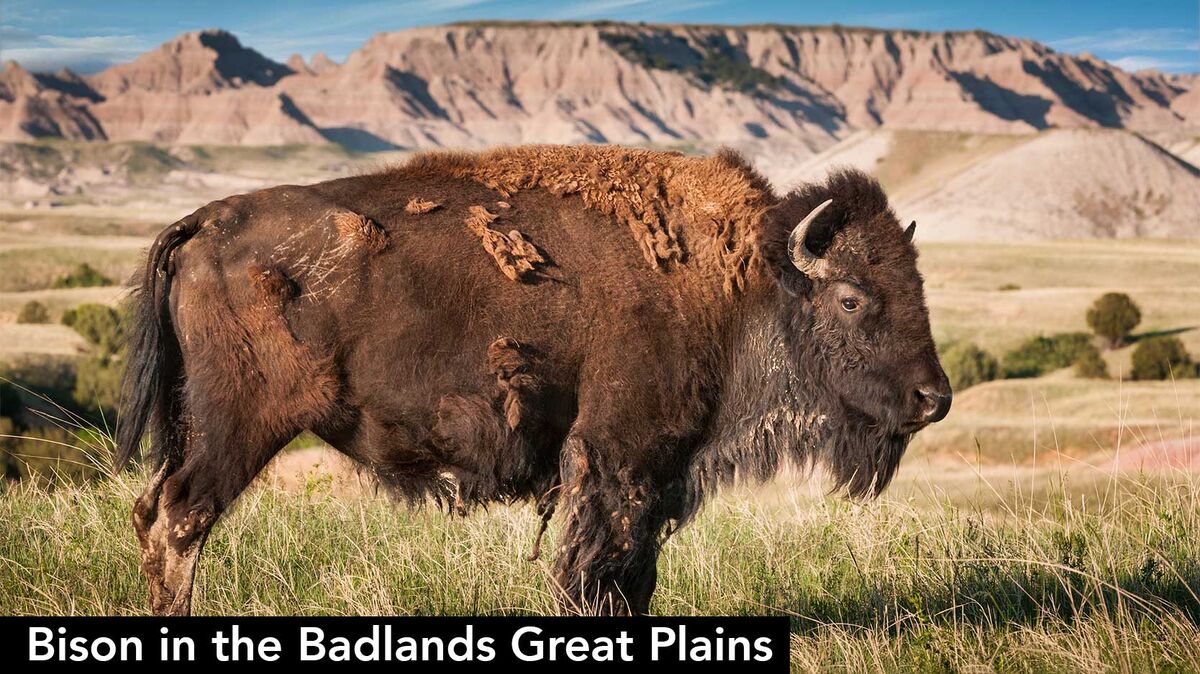
Examples of Plains Around the World
Plains are a major landform known for their sea-level elevation and wide expanses. They are found between mountain ranges and are usually formed by erosion or deposits of water and lava. The total amount of land covered by plains is over 19 million square miles – more than one-third of the total land surface area on Earth.
Some examples of plains around the world and their areas include:
- Australian Plains (Australia) - 2,966,200 square miles
- European Plain (Central and East Europe) - 2,000,000 square miles
- Great Plains (United States) - 1,100,000 square miles
- Indus Valley Plain (Pakistan) - 200,000 square miles
- West Siberian Plain (Russia) - 1,200,000 square miles
Minor Landforms
There are hundreds of minor landforms in the world. These landforms are created over millions of years by processes such as wind erosion, water erosion, tectonic activity, weathering, ocean currents, and volcanic eruptions. They’re found in various biomes, and despite how sedentary some of them look, they are always changing.
Desert Landforms and Geographic Features
Landforms in desert biomes are often known as Aeolian landforms, named for Aeolus, the Greek god of wind. They are formed by either the erosive or constructive action of the wind. As the wind erodes the land it has the effect of sandblasting the surface of rocks or other geological features.
Examples of desert landforms include:
- barchan - a convex-shaped sand dune with a gentle slope up the side of the wind direction and a 30-35 degree slip face that faces away from the wind
- blowout - a small hollow
- desert pavement - a sheet-like surface of rock
- desert varnish - a dark stain on the surfaces of desert rocks
- dreikanter - a three-faced weathered rock
- dry lake - a waterless lakebed, typically covered in fine-grained rocks that contain salt
- dune - a hill or mountain of sand
- erg - a sand covered desert
- loess - an accumulation of sediment or silt that are joined together by calcium carbonate
- sandhill - a sandy or low-vegetation hill area that receives minimal rainfall and has trouble retaining the water
- ventifact - rocks that have been cut and polished by the wind
- yardang - very large or very long, streamlined, sculpted forms caused by wind erosion
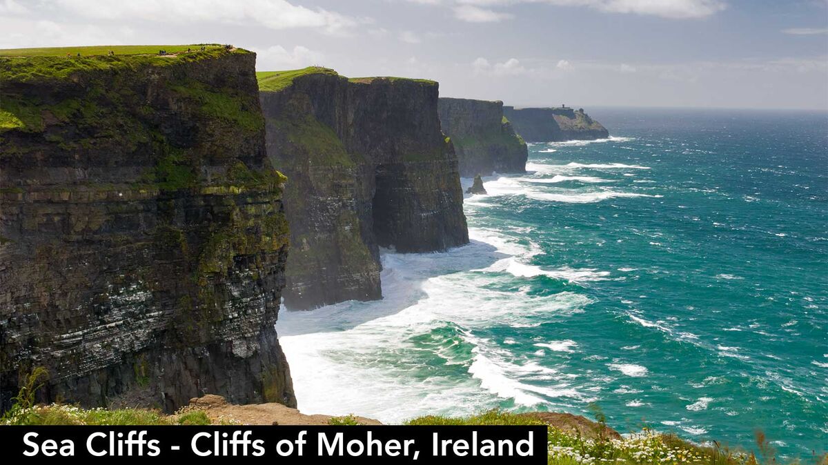
Coastal Landforms and Geographic Features
Coastal landforms are found on the edges of the ocean. They are primarily formed by water erosion from ocean currents over many years, as well as wind erosion and tectonic plate activity. Landforms such as islands and archipelagos are formed by underwater volcanoes.
- arch - a rock formation with an opening
- archipelago - a group of islands
- ayre - a narrow beach across the ends of a shallow bay
- barrier bar and barrier island - a flat formation of sand that is parallel to the coast
- beach and raised beach - the land along the edge of a body of water, consisting of loose rocks or sand
- beach cusps - sediment in an arc shape on the shore, caused by the wave action
- beach ridge - a ridge running parallel to the water's edge, caused by wave action
- bight - a recessed area in a coastline
- blowhole - a hole in the end of a sea cave
- calanque - a steep cove
- cape - a portion of land that extends into the sea or ocean
- coast - where the water meets the land
- cove - a small bay
- cuspate foreland - an accumulation of sand and gravel forming a land body that extends like a "finger" into the body of water
- dune system - groups of sand dunes
- firth - a large bay
- fjard - a short, shallow and broad fjord
- fjord - a long narrow inlet with steep cliffs
- headland - a point of land that extends into a body of water and has a steep drop
- island, islet - a portion of land that is surrounded on all sides by water
- isthmus - a narrow strip of land with water on each side
- machair - the grassy fields that are inland from a dune ridge
- marine terrace - a flat, often slightly inclined, surface with a slight slope on the water side and a steeper slope on the land side
- peninsula - a piece of land that has water on three sides
- sea cave - a cave at the edge of the sea that is formed by wave action
- sea cliff - a vertical wall of rock at the coastline
- shoal - a sandbar
- shore - where the water meets the land
- surge channel - a very narrow opening in the rocks of the shoreline
- wave cut platform - the flat area at the base of a cliff created by the waves
Oceanic Landforms and Geographic Features
Underwater landforms are formed in the same ways as their above-ground counterparts: tectonic and volcanic activity. Many oceanic landforms are also formed by water currents. Take a look at these examples of minor landforms and geographic features in the ocean.
- abyssal fan - an underwater deposit of sediment formed by water currents
- abyssal plain - a flat, smooth underwater surface that covers over 50% of the Earth's surface; it forms the bottom of the continental rise and the top of the oceanic trench
- atoll - a ring-shaped coral reef
- bay and gulf - a body of water connected to an ocean but surrounded on most sides by land
- channel - a narrow body of water
- continental shelf - the extended edge of each continent which is underwater
- coral reef - underwater formations of calcium carbonate
- estuary - a semi-enclosed body of water with a connection to the sea and with at least one inbound source of water
- inlet - a connection between a bay and the ocean
- islet - a rock that is surrounded on all sides by water
- lagoon - a shallow body of water
- mid-ocean ridge - an underwater mountain system
- ocean - a body of salt water
- oceanic basin - a basin that is below sea level
- oceanic plateau - a flat rock formation that is above the continental slope
- oceanic trench - a long, narrow opening on the ocean floor
- ria - a river valley that is open to the sea
- river delta - a deposit of sediment at the mouth of a river where it flows into a larger body of water
- salt marsh - an area between the saltwater sea and a piece of land that is flooded by salt water
- seamount - an underwater mountain
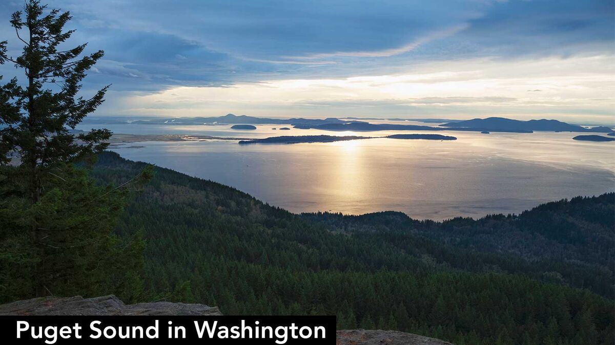
- sea - the salty water that covers 70% of the Earth
- sound - a large ocean channel between two bodies of land
- spit - a piece of land that extends into water
- strait - a narrow waterway that connects two larger bodies of water
- strandflat - the low land on the Arctic and Antarctic coasts
- submarine canyon - a steep valley in the sea floor
Mountain Range Landforms and Geographic Features
Mountains are formed by activity between tectonic plates, but many landforms in mountainous areas are formed by erosion and weathering. Take a look at these landforms and geographic features found in mountain ranges.
- badlands - a dry terrain with steep slopes and little or no vegetation
- butte - an isolated hill that typically has a flat stop and steep sides
- canyon - a deep ravine between two cliffs or encasements, like the Grand Canyon
- cave - an underground space created by the weathering of rocks that is enclosed and large enough to enter
- cliff - an area with a steep drop-off, usually formed by erosion and near rock exposures
- cuesta - a hill or a ridge with a gentle slope
- gulch - a deep valley that has generally been formed by land erosion
- gully - a ditch or valley created by erosion
- hogback - a narrow ridge of hills with steep slopes and a narrow crest; the slopes are usually close to equal on both sides
- hoodoo - a tall thin rock formation protruding from the bottom of a badland
- lavaka - a hole in the side of a hill caused by erosion
- mesa - a tableland, or an elevated area with a flat top and steep cliff-like sides
- mountain pass - a path through a mountain range over a low point in a ridge
- ravine - formed by running water, a ravine is smaller than a canyon and is steep and deep
- ridge - a chain of hills or mountains
- rock shelter - a cave-like opening at the base of a cliff
- scree - a collection of broken rocks at the base of a mountain
- strath - a wide shallow river valley
- summit - the highest point on a hill or mountain
- valley - a low area between hills or mountains
Volcanic Landforms and Geographical Features
When you picture volcanoes, you probably imagine huge explosions of lava and ash during an eruption. But underwater volcanoes are just as prevalent as volcanoes on land. Check out these landforms and geographic features found in volcanic areas.
- caldera - a crater formed by the collapse of land after an eruption
- complex volcano - a volcano with more than one feature because of multiple vents
- crater lake - a lake that formed inside a caldera
- cryovolcano - erupts water, methane or ammonia rather than lava
- geyser - a hole in the ground where water and steam shoots out
- guyot - a volcano under the water with a flat top
- lava dome - a mound that forms by lava that does not easily flow away
- lava flow - lava that is moving
- lava plain - a large area of lava flows
- lava spine - a vertical formation formed by slow-moving lava
- maar - a shallow volcanic crater caused by an explosion of groundwater water contacting magma or lava
- malpais - an area of eroded volcanic rocks
- mid-ocean ridge - an underwater chain of mountains where upwelling magma forms new crust
- mud volcano - a mound formed when gas comes through a vent and causes mud to boil
- oceanic trench - a very long steep depression in the ocean floor
- pit crater - formed by a collapse of the surface rather than an eruption
- sand volcano - made of ejected sand
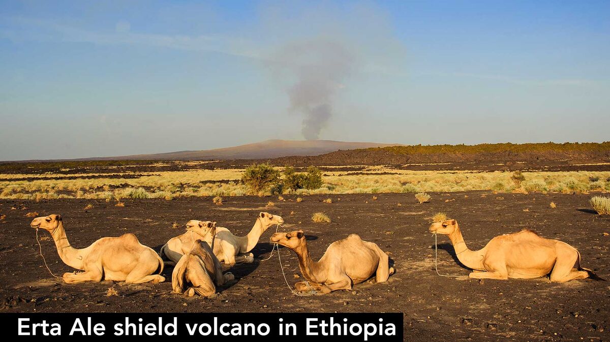
- shield volcano - a large domed volcano with gently sloping sides
- stratovolcano - a conical volcano with steep sides
- subglacial mound - formed by eruption under a glacier
- submarine volcano - an underwater vent where magma may erupt
- supervolcano - a volcano that may eject a volume of more than 240 cubic miles
- tuya - a volcano with steep sides and a flat top made by lava erupting through a glacier
- vent - an opening through which lava, ash and gas can escape
- volcanic arc - a chain of volcanoes positioned in a slightly curved layout
- volcanic dam - a natural dam made of lava or other volcanic material and debris
- volcanic field - an area with a cluster of volcanoes
- volcanic island - a volcano under the ocean that grew until it broke the surface of the water
- volcanic plateau - a flat surface formed by many volcanic eruptions
- volcanic plug - forms when magma cools and hardens within a vent
- volcano - a mountain formed by an eruption of lava and ash
The World of Geography
These major and minor landforms make up the natural world around us. Between the highest mountain and the lowest oceanic trench lies these geographical and geological wonders of our world. To explore more about the tectonic plates and activities that form these landforms, take a look at the three main types of faults in geology.